WA5907 : Chateau de Longis from Mannez Garenne
Chateau de Longis from Mannez Garenne
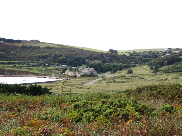
The buildings at the western end of Longis Bay are labelled Chateau de Longis on the map, but they also seem to be named as 'The Nunnery' in some guides. This was a zoomed-in photo taken from the top of Mannez Garenne.
![Creative Commons Licence [Some Rights Reserved]](http://s0.geograph.org.gg/img/somerights20.gif)
year taken
2012
| Find out how to reuse this Image For example on your webpage, blog, a forum, or Wikipedia. | |||||
| Suggest an Update to this Image | Contact the contributor | ||||
- Grid Square
- WA5907, 10 images (more nearby)
- Photographer
- John Rostron (find more nearby)
- Image classification
- Supplemental image
- Date Taken
- Saturday, 22 September, 2012 (more nearby)
- Submitted
- Sunday, 4 November, 2012
- Category
- Island scenery (more nearby)
- Subject Location
-
MGRS:
 WA 5945 0776 [10m precision]
WGS84: 49:43.1643N 2:10.5153W - Photographer Location
-
MGRS: WA 59796 08459
- View Direction
- South-southwest (about 202 degrees)