WV3178 : Parish Boundary
Parish Boundary
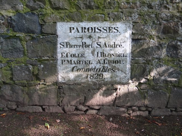
Plaque on the wall at the roadside denoting that you are moving between St Peter Port and St Andrews parishes.
![Creative Commons Licence [Some Rights Reserved]](http://s0.geograph.org.gg/img/somerights20.gif)
year taken
2012
| Find out how to reuse this Image For example on your webpage, blog, a forum, or Wikipedia. | |||||
| Suggest an Update to this Image | Contact the contributor | ||||
- Grid Square
- WV3178, 6 images (more nearby)
- Photographer
- Ian Paterson (find more nearby)
- Image classification
- Supplemental image
- Date Taken
- Wednesday, 30 May, 2012 (more nearby)
- Submitted
- Monday, 4 June, 2012
- Category
- Parish Boundary (more nearby)
- Subject Location
-
MGRS:
 WV 3173 7872 [10m precision]
WGS84: 49:27.6184N 2:33.7284W - Photographer Location
-
MGRS: WV 3174 7873
- View Direction
- Southwest (about 225 degrees)