Geographing Guide
A good Geograph presents images and information on the main human and physical geographical feature(s) present in any given ordnance survey 1km grid square.
Photos need not be master works of art, the important thing is the human and physical geographical information they contain.
You can plan your Geograph using a hardcopy map or by visiting the
Get-a-map™![]() website or for really high tech geographing, you could use a
Pocket PC or GPS equipped with mapping software (for example Memory Map).
website or for really high tech geographing, you could use a
Pocket PC or GPS equipped with mapping software (for example Memory Map).
Example
I entered my home village of Billinge in the search box on the
Get-a-map![]() page
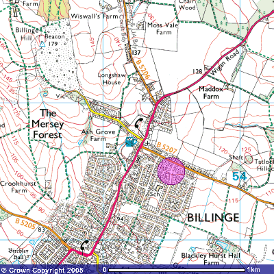
and the result was this map (The purple spot indicates the centre of the
SD5300 grid square).
page
and the result was this map (The purple spot indicates the centre of the
SD5300 grid square).
The Getamap site also allows searching by grid reference and using this method you can select a grid reference from our website that hasn't yet been Geographed and look at its main features.
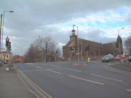
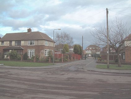
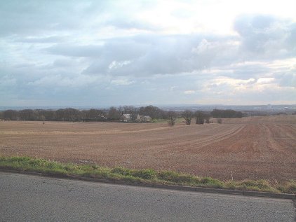
Our selected map square is primarily a residential area with a staggered cross road at the junction of the A571 and B5207. There is a church at the crossroads at 533007 and a school close to the centre of the square in the heart of the residential area. From local knowledge, open farmland dominates the Eastern third of the grid square.
Sample photographs for SD5300
Examples of representative photographs for the above location:
- See What is a geograph? for more examples of images submitted to geograph and how they are moderated.