WV7152 : St Catherine's Breakwater
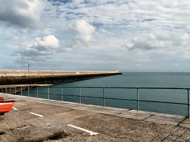
St Catherine's Breakwater
St Catherine's Breakwater, strictly called Verclut Breakwater, but invariably known as the former by islanders, was built in the middle of the 19th century as the northern arm of what was to be a massive naval station. It would have been the largest harbour on the south side of the Channel after Le Havre. Link
![Creative Commons Licence [Some Rights Reserved]](http://s0.geograph.org.gg/img/somerights20.gif)
year taken
2010
| Find out how to reuse this Image For example on your webpage, blog, a forum, or Wikipedia. | |||||
| Suggest an Update to this Image | Contact the contributor | ||||
- Grid Square
- WV7152, 30 images (more nearby)
- Photographer
- Gerald England (find more nearby)
- Image classification
- Geograph
- Date Taken
- Wednesday, 6 October, 2010 (more nearby)
- Submitted
- Wednesday, 3 November, 2010
- Category
- Breakwater (more nearby)
- Subject Location
-
MGRS:
 WV 7178 5271 [10m precision]
WGS84: 49:13.3780N 2:0.8528W - Photographer Location
-
MGRS: WV 7118 5277
- View Direction
- EAST (about 90 degrees)