WV4674 : Cliff Path South-east of La Coupee
Cliff Path South-east of La Coupee
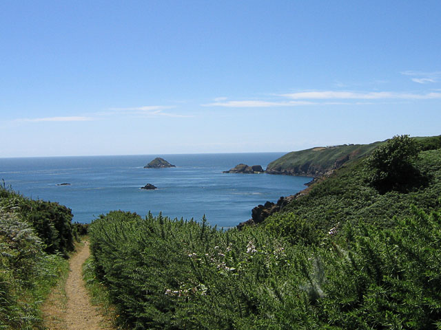
This path, which carries on to the left, leads along the southern coast from La Coupee to Dixcart Bay. The headland on the right is part of Little Sark. I remember the date well, since it was our 40th wedding anniversary, and we spent out honeymoon on Sark
![Creative Commons Licence [Some Rights Reserved]](http://s0.geograph.org.gg/img/somerights20.gif)
year taken
2008
| Find out how to reuse this Image For example on your webpage, blog, a forum, or Wikipedia. | |||||
| Suggest an Update to this Image | Contact the contributor | ||||
- Grid Square
- WV4674, 10 images (more nearby)
- Photographer
- John Rostron (find more nearby)
- Image classification
- Geograph (First for WV4674)
- Date Taken
- Sunday, 20 July, 2008 (more nearby)
- Submitted
- Sunday, 18 April, 2010
- Category
- Coastal scenery (more nearby)
- Subject Location
-
MGRS:
 WV 4622 7449 [10m precision]
WGS84: 49:25.2798N 2:21.7613W - Photographer Location
-
MGRS: WV 4608 7442
- View Direction
- East-northeast (about 67 degrees)