WV3582 : Vale Mill & fortifications
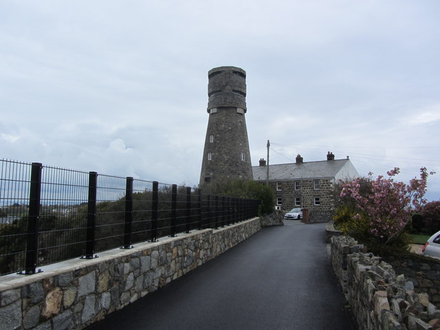
Vale Mill & fortifications
Dating from around 1770, Vale Mill was once a flour mill. after falling into disuse it was taken over by the Germans in 1940 and extended upwards to form a anti aircraft position and range finding station. It was disguised by the Germans in World war 2 as a windmill complete with sails foil an attack by the British.
![Creative Commons Licence [Some Rights Reserved]](http://s0.geograph.org.gg/img/somerights20.gif)
year taken
2012
| Find out how to reuse this Image For example on your webpage, blog, a forum, or Wikipedia. | |||||
| Suggest an Update to this Image | Contact the contributor | ||||
- Grid Square
- WV3582, 15 images (more nearby)
- Photographer
- Colin Park (find more nearby)
- Image classification
- Geograph
- Date Taken
- Saturday, 28 April, 2012 (more nearby)
- Submitted
- Wednesday, 2 May, 2012
- Category
- former mill (more nearby)
- Subject Location
-
MGRS:
 WV 3517 8230 [10m precision]
WGS84: 49:29.5390N 2:30.8612W - Photographer Location
-
MGRS: WV 3514 8227
- View Direction
- Northeast (about 45 degrees)