WV5548 : Tidal rocks to the north of La Corbière lighthouse
Tidal rocks to the north of La Corbière lighthouse
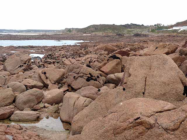
Looking northeast towards La Pulente peninsula at low tide. With a tidal range of as much as 12 metres, the area of Jersey increases by 40% from 117 square kilometres at high tide to 163 square kilometres at low tide, with extensive areas of rock and sand uncovered.
![Creative Commons Licence [Some Rights Reserved]](http://s0.geograph.org.gg/img/somerights20.gif)
year taken
2011
| Find out how to reuse this Image For example on your webpage, blog, a forum, or Wikipedia. | |||||
| Suggest an Update to this Image | Contact the contributor | ||||
- Grid Square
- WV5548, 7 images (more nearby)
- Photographer
- Oliver Dixon (find more nearby)
- Image classification
- Geograph
- Date Taken
- Tuesday, 18 October, 2011 (more nearby)
- Submitted
- Wednesday, 25 January, 2012
- Category
- Coastal scenery (more nearby)
- Subject Location
-
MGRS:
 WV 5556 4837 [10m precision]
WGS84: 49:11.1370N 2:14.2528W - Photographer Location
-
MGRS: WV 5504 4805
- View Direction
- East-northeast (about 67 degrees)