WV6046 : Observation tower, Noirmont Point
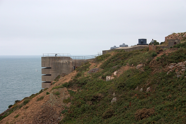
Observation tower, Noirmont Point
MP1 Naval direction and range finding position.
The massive 16 metre high tower was built between April and October 1943 requiring an estimated 5,000 bags of cement.
A 2cm anti aircraft gun was fitted on the roof.
One of only three that were built out of 9 planned around Jersey.
It was thought that any two towers seeing a target could report their bearings from which the range could be determined, but was found difficult to use with multiple moving targets.
The 6 metre stereoscopic range finder (seen located behind the tower) worked on its own without communication delay problems.
![Creative Commons Licence [Some Rights Reserved]](http://s0.geograph.org.gg/img/somerights20.gif)
year taken
2009
| Find out how to reuse this Image For example on your webpage, blog, a forum, or Wikipedia. | |||||
| Suggest an Update to this Image | Contact the contributor | ||||
- Grid Square
- WV6046, 31 images (more nearby)
- Photographer
- Bob Embleton (find more nearby)
- Image classification
- Geograph
- Date Taken
- Wednesday, 12 August, 2009 (more nearby)
- Submitted
- Thursday, 27 May, 2010
- Category
- WW II defences (more nearby)
- Subject Location
-
MGRS:
 WV 6049 4631 [10m precision]
WGS84: 49:9.9973N 2:10.2125W - Photographer Location
-
MGRS: WV 6062 4633
- View Direction
- WEST (about 270 degrees)