WV5454 : Strongpoint L' Etacquerel
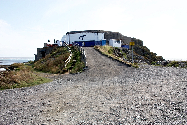
Strongpoint L' Etacquerel
A massive concrete German bunker built by the Todt Organisation using slave and forced labour now in use as a fish market overlooking Le Pulec Bay.
![Creative Commons Licence [Some Rights Reserved]](http://s0.geograph.org.gg/img/somerights20.gif)
year taken
2009
| Find out how to reuse this Image For example on your webpage, blog, a forum, or Wikipedia. | |||||
| Suggest an Update to this Image | Contact the contributor | ||||
- Grid Square
- WV5454, 44 images (more nearby)
- Photographer
- Bob Embleton (find more nearby)
- Image classification
- Geograph
- Date Taken
- Thursday, 20 August, 2009 (more nearby)
- Submitted
- Thursday, 27 May, 2010
- Category
- WW II defences (more nearby)
- Subject Location
-
MGRS:
 WV 5460 5442 [10m precision]
WGS84: 49:14.4072N 2:14.9938W - Photographer Location
-
MGRS: WV 5463 5447
- View Direction
- South-southwest (about 202 degrees)